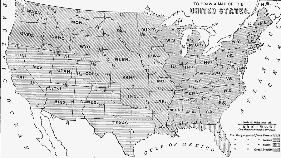
Description: A map skills exercise from 1872 showing the drawing of the United States with proportional measurements. The map shows state and territory boundaries at the time (Dakota, Montana, Washington, Idaho, Wyoming, Utah, Oklahoma, New Mexico, and Arizona were not yet states). The map is keyed to show the countries from which the territories were acquired, including the territories from Great Britain, France, Spain, and Mexico.
Place Names: A Complete Map of the United States, Maine, �New York, �Florida, �Texas, �California, �Washington, �Kansas,
ISO Topic Categories: boundaries,
inlandWaters,
location,
oceans
Keywords: Drawing the United States, physical, �political, �map drawing, �kmapdraw, kMapSkills, physical features, major political subdivisions, boundaries,
inlandWaters,
location,
oceans, Unknown, 1872
Source: James Monteith, Comprehensive Geography (New York, NY: A. S. Barnes and Company, 1872) 101
Map Credit: Courtesy the private collection of Roy Winkelman |
|