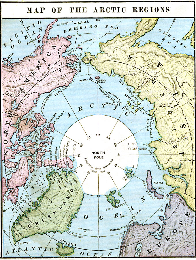
Description: A map of the North Polar Region from 1883 showing the extent of known land above 80° North, and the route of McClure (1850–1853) from the Behring Sea to the Atlantic, Nordenskiold (1878–1879), and De Long (1881).
Place Names: Arctic Region, North America, �Asia, �Siberia, �Europe, �Greenland,�Iceland,
ISO Topic Categories: boundaries,
oceans,
location,
inlandWaters
Keywords: Map of the Arctic Regions, physical, physical features, boundaries,
oceans,
location,
inlandWaters, Unknown, 1883
Source: , Handy Atlas of the World (New York, NY: Ivison, Blakeman, Taylor and Co., 1883) 5
Map Credit: Courtesy the private collection of Roy Winkelman |
|