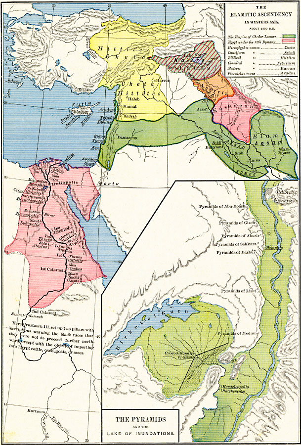
Description: A map of western Asia showing the Elamitic Ascendancy and extent of the Egyptian territory during the twelfth dynasty, about 2100 BC. The map is color–coded to show the Empire of Chedor–Laomer (King of Elam) from the Mediterranean to the Babylon territories of Akkad and Sumer, the territory of the Kossaeans, Assyria, Na'iri, the territories of the Cheta Hittites, and the extent of the Egyptian territory during the twelfth dynasty. The map shows important historical cities of the time and rivers, using name forms (hieroglyphic, cuneiform, biblical, classical, and modern) where appropriate. An inset map details the portion of the Nile River near Memphis and Heracleopolis with its numerous pyramids and the Lake of Inundation.
Place Names: Southwest Asia, Assyria, �Babylon, �Damascus, �Egypt, �Heliopoli
ISO Topic Categories: oceans,
location,
inlandWaters,
boundaries
Keywords: The Elamitic Ascendancy in Western Asia, borders, �political, �historical, major political subdivisions, historical event, oceans,
location,
inlandWaters,
boundaries, Unknown, about 2100 BC
Source: Robert H. Labberton, New Historical Atlas and General History (New York, NY: Townsend MacCoun, 1886) Plate II
Map Credit: Courtesy the private collection of Roy Winkelman |
|