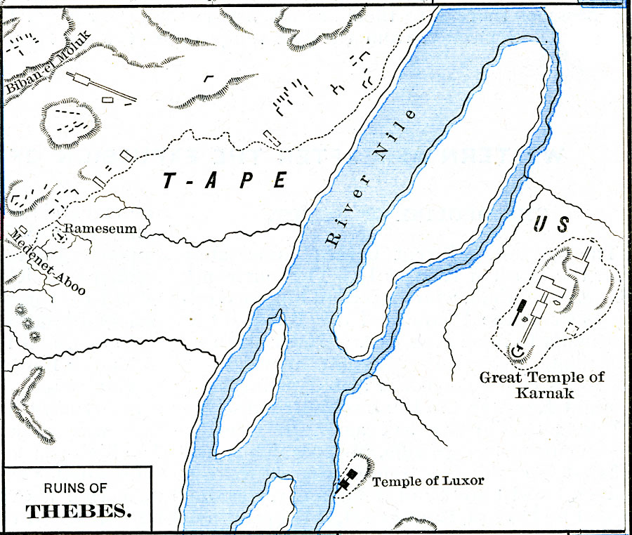
Description: Map of the Ruins of Thebes along the Nile in Egypt including the Rameseum, the Great Temple of Karnak, and the Temple of Luxor.
Place Names: Egypt, Medenet-Aboo, �Nile River, �Rameseum, �T-Ape, Temple of Luxor, Temple of Karnak
ISO Topic Categories: oceans,
location,
inlandWaters
Keywords: Ruins of Thebes, borders, �historical, kAncientEgypt, historical event, oceans,
location,
inlandWaters, Unknown, about 1250 BCE
Source: Robert H. Labberton, New Historical Atlas and General History (New York, NY: Townsend MacCoun, 1886) Plate IV
Map Credit: Courtesy the private collection of Roy Winkelman |
|