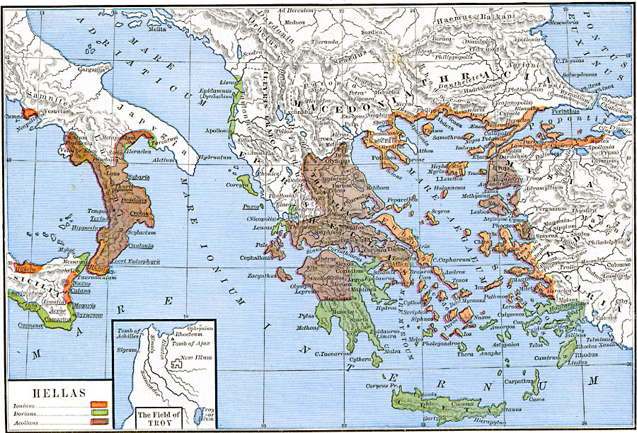
Description: A map of the Hellenes settlements in 550 BC before the Persian Wars, including the southern Balkan Peninsula, the islands and coastal regions of the Mare Aegaeum (Aegean Sea), the southern tip of the Italian Peninsula and Sicily. This map is color–coded to show the territories of the Ionians, Dorians, and Aeolians. The map highlights the maritime nature of the Greek settlements. Important cities and geographic features of the time are shown, many with ancient place names, such as Pontus Euxinus (Black Sea), Mare Adriaticum (Adriatic Sea), and Mare Internum (Mediterranean Sea). An inset map shows the Field of Troy in Mysia, with New Ilium, the Tomb of Ajax and the Tomb of Achilles, and the rivers Rhoetes, Simois, and Scamander.
Place Names: Greece, Crete, �Epirus, �Hellas, �Lucania, �Lydia, �Macedonia, �Mycia, �Thessalia, �Thracia, Sicilia
ISO Topic Categories: oceans,
location,
inlandWaters,
boundaries
Keywords: Hellas, borders, �political, kAncientGreece, major political subdivisions, oceans,
location,
inlandWaters,
boundaries, Unknown, 550 BC
Source: Robert H. Labberton, New Historical Atlas and General History (New York, NY: Townsend MacCoun, 1886) Plate VIII
Map Credit: Courtesy the private collection of Roy Winkelman |
|