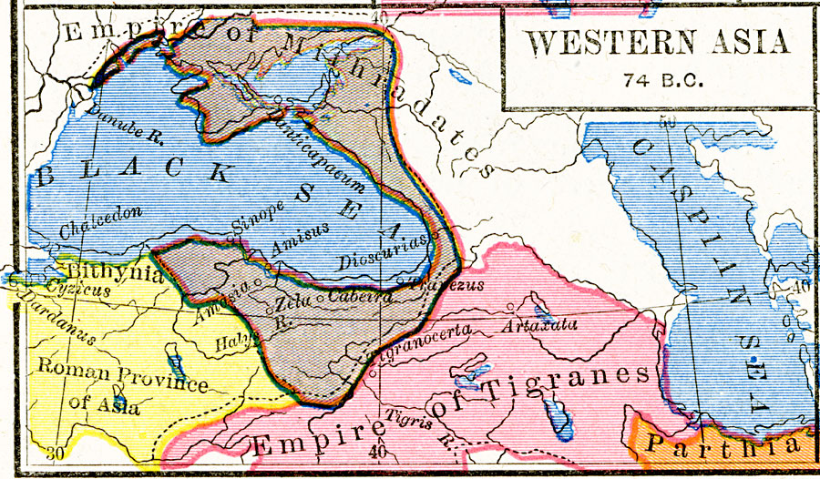
Description: A map of western Asia in the Pontus (Black Sea) region at the time of the third Mithridatic War fought between Mithridates VI of Pontus and the Roman Republic, around 74 BC. The map is color–coded to show the territory of King Mithridates, the Bithynia Province of the Roman Empire, and portions of Parthia and the Empire of Tigranes. The map shows the significance of trade routes to the east towards the Caspian Sea, south along the Tigris River to Mesopotamia, north beyond Crimea to the Don River, towards Europe along the Danube River, and to the Mediterranean Sea through the Bosporus. Important cities of the region include Cyzicus, Chalcedon, Sinope, Dioscurias, Trapezus, and Panticapaeum.
Place Names: Southwest Asia, Bithynia, �Mithradates, �Parthia, �Tigrane
ISO Topic Categories: oceans,
location,
inlandWaters,
boundaries
Keywords: Western Asia, borders, �political, major political subdivisions, oceans,
location,
inlandWaters,
boundaries, Unknown, about 74 BC
Source: Robert H. Labberton, New Historical Atlas and General History (New York, NY: Townsend MacCoun, 1886) Plate XII
Map Credit: Courtesy the private collection of Roy Winkelman |
|