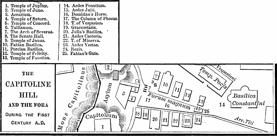
Description: A plan of the Capitoline Hill and the Fora in Rome during the First Century AD. The plan shows the Temple of Jupiter (1), Temple of Juno (2), Aerarium (3), Temple of Saturn (4), Temple of Concord (5), Tullianum (6), Arch of Severus (7), Senate Hall (8), Temple of Janus (9), Fabian Basilica (10), Porcian Basilica (11), Temple of Felicity (12), Temple of Faustina (13), Aedes Penatium (14), Aedes Julii (15), Domitian's Horse (16), Column of Phocas (17), Temple of Vespasian (18), Graccostasis (19), Julia's Basilica (20), Aedes Castoria (21), Temple of Minerva (22), Aedes Vestae (23), Regia (24), and Fabian's Gate (25). This map also shows the Mons Capitolinus, Forum Magnum, Temple of Pacis, and the Basilica Constantini.
Place Names: Italy, Rom
ISO Topic Categories: oceans,
location,
inlandWaters
Keywords: The Capitoline Hill and the For a, borders, kAncientRome, oceans,
location,
inlandWaters, Unknown, First Century A.D.
Source: Robert H. Labberton, New Historical Atlas and General History (New York, NY: Townsend MacCoun, 1886) Plate XIX
Map Credit: Courtesy the private collection of Roy Winkelman |
|