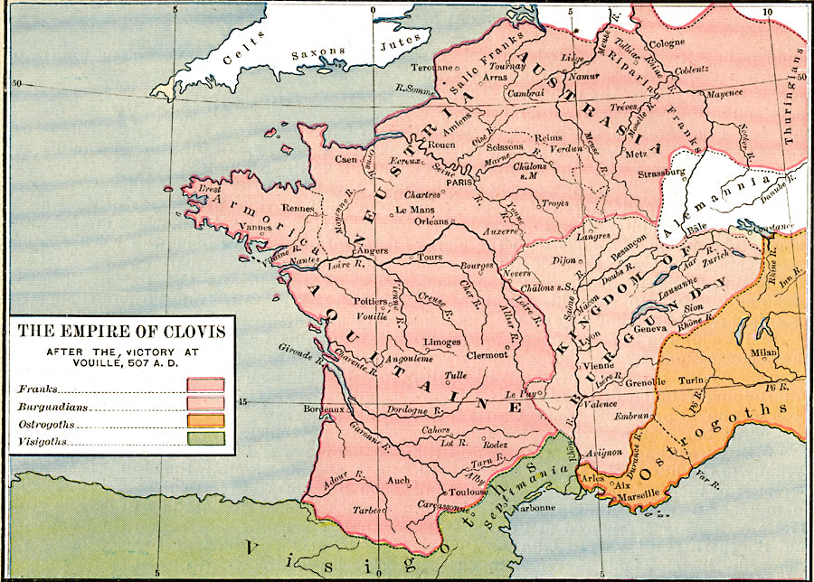
Description: A map showing the Empire of Clovis after the victory at Vouille, AD 507, including Austrasia, Neustria, Amorica, and Aquitaine. This map is color–coded to show the territories of the Kingdom of Burgundy, and portions of Alemannia, the Ostrogoths, and the Visigoths, including Septimania. Other groups shown on the map are the Celts, Saxons, and Jutes in the British Isles, and the Salic Franks, Riparian Franks, and Thuringians in Austrasia. Important cities of the period and major rivers are shown.
Place Names: Western and Central Europe, Aquitaine, �Austrasia, �Burgundy, �Neustri
ISO Topic Categories: oceans,
location,
inlandWaters,
boundaries
Keywords: The Empire of Clovis after the victory at Vouille, borders, �historical, other military, oceans,
location,
inlandWaters,
boundaries, Unknown, AD 507
Source: Robert H. Labberton, New Historical Atlas and General History (New York, NY: Townsend MacCoun, 1886) Plate XXIII
Map Credit: Courtesy the private collection of Roy Winkelman |
|