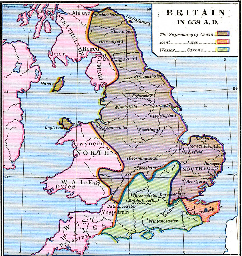
Description: A map of Britain in AD 658. This map is color–coded to show the territories of the Celtic tribes, the Supremacy of Oswin, Kent (Jutes), and Wessex (Saxons). The map shows important cities and ports of the time, labeled with their Celtic, Latin, and Old English names.
Place Names: United Kingdom, Cumbria, �Kent, �Northfolk, �Southfolk, �Strathclyde, �Wale
ISO Topic Categories: oceans,
location,
inlandWaters,
boundaries
Keywords: Britain, borders, oceans,
location,
inlandWaters,
boundaries, Unknown, AD 658
Source: Robert H. Labberton, New Historical Atlas and General History (New York, NY: Townsend MacCoun, 1886) Plate XXV
Map Credit: Courtesy the private collection of Roy Winkelman |
|