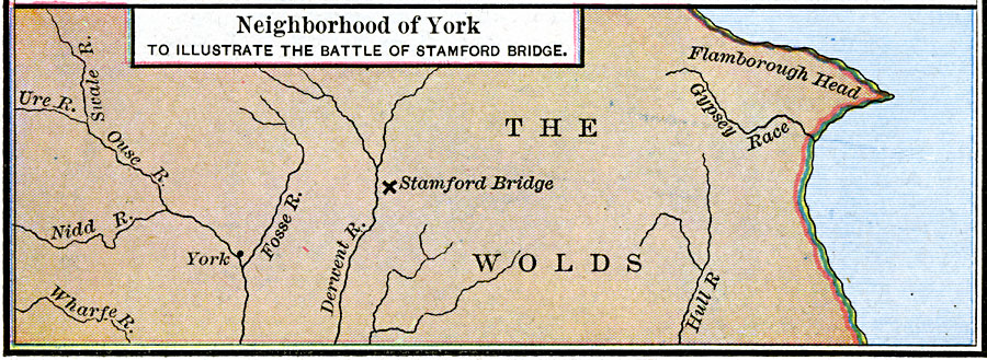
Description: A map of Yorkshire, England, in the neighborhood of York, showing the location of the Battle of Stamford Bridge (25 September, 1066). The battle was fought between and allied army of Norwegians and Northumbrian rebels under King Hardraada, and the Anglo–Saxon army under King Harold Godwinson, and resulted in the Anglo–Saxons repelling the Norwegian invaders. This battle took place less than three weeks before the Battle of Senlac Hill (Hastings), the first battle of the Norman Conquest of England (14 October, 1066), a battle in which King Godwinson was killed.
Place Names: United Kingdom, Flamborough Head, �Stamford, �Wolds, �Yor
ISO Topic Categories: oceans,
location,
inlandWaters,
boundaries
Keywords: Neighborhood of York to illustrate the Battle of Stamford Bridge, borders, kBattle, oceans,
location,
inlandWaters,
boundaries, Unknown, September 25, 1066
Source: Robert H. Labberton, New Historical Atlas and General History (New York, NY: Townsend MacCoun, 1886) Plate XXXI
Map Credit: Courtesy the private collection of Roy Winkelman |
|