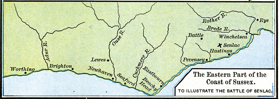
Description: A map of coastal Sussex, England, at the time of the Norman Invasion (1066). This map shows Senlac Hill, battle site of the Battle of Hastings (14 October, 1066) between the Normans under William of Normandy (William the Conqueror) and the Anglo–Saxons under King Harold Godwinson. Godwinson was killed in this battle, and the Anglo–Saxon defeat was beginning of the Norman conquest of Britain. The map shows the towns of Worthing, Brighton, Lewes, Newhaven, Seaford, Eastbourne, Pevensey, Hastings, Battle, Winchelsea, and Rye, Beachy Head, and the rivers Adur, Ouse, Cuckmere, Brede, and Rother.
Place Names: United Kingdom, Brighton, �Eastbourne, �Hastings, �Newhaven, �Pevensy, �Senlac, �Winchelsea, �Worthin
ISO Topic Categories: oceans,
location,
inlandWaters,
boundaries
Keywords: The Eastern Part of the Coast of Sussex to illustrate the Battle of Senlac, borders, �historical, other military, oceans,
location,
inlandWaters,
boundaries, Unknown, October 14, 1066
Source: Robert H. Labberton, New Historical Atlas and General History (New York, NY: Townsend MacCoun, 1886) Plate XXXI
Map Credit: Courtesy the private collection of Roy Winkelman |
|