mapsMaps ETC Site map
 Maps ETC > Europe > United Kingdom > The Battlefields of the War of the Roses, 1455–1485
Site Map 

The Battlefields of the War of the Roses, 1455–1485

The Battlefields of the War of the Roses


Title: The Battlefields of the War of the Roses
Projection: Unknown,
Source Bounding Coordinates:
W: -2 E: 1 N: 55 S: 51

Main Map Page
Zoomify Version
B/W PDF Version
Color PDF Version
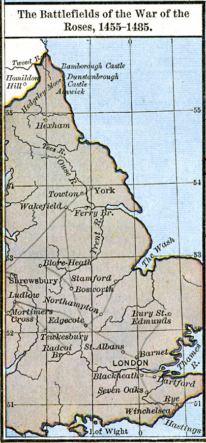
Description: Map showing the Battlefields of the War of the Roses, 1455–1485.
Place Names: United Kingdom, Isle of Wight, London, Shrewsbury, Yor
ISO Topic Categories: oceans, location, inlandWaters
Keywords: The Battlefields of the War of the Roses, borders, historical, other military, oceans, location, inlandWaters, Unknown, 1455–1485
Source: Robert H. Labberton, New Historical Atlas and General History (New York, NY: Townsend MacCoun, 1886) Plate XXXVIII
Map Credit: Courtesy the private collection of Roy Winkelman
SearchLicensePDF HelpGIS Help Google Earth Help Zoomify Help

 Maps ETC > Europe > United Kingdom > The Battlefields of the War of the Roses, 1455–1485
Site Map