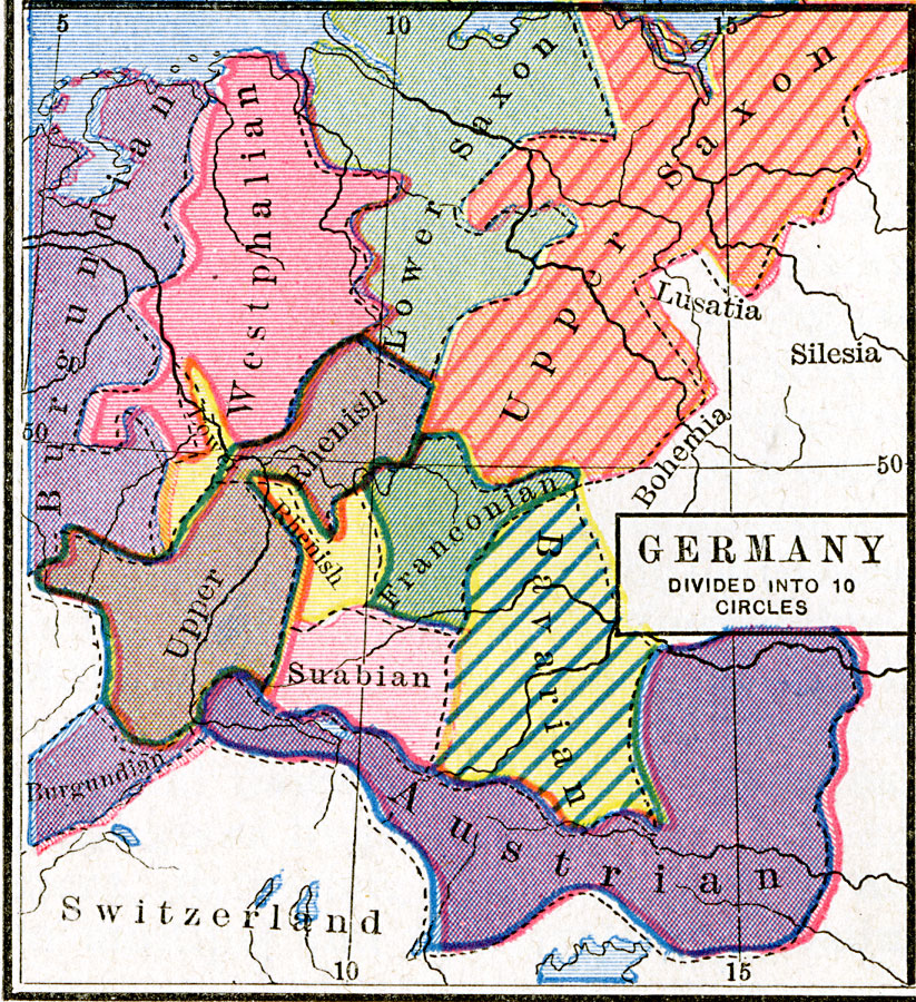
Description: A map of the ten regional Imperial Circles of Germany, (Burgundian, Westphalian, Lower Saxon, Upper Saxon, Lower Rhenish, Upper Rhenish, Franconian, Suabian, Bavarian, and Austrian) created after 1543, when Charles V established the boundaries of archbishoprics, bishoprics, and territories of the western (German) portion of the Empire.
Place Names: Germany, Austria, �Bavaria, �Burgundy, �Lower Saxon, �Upper Saxon, �Westphalia,
ISO Topic Categories: oceans,
location,
inlandWaters,
boundaries
Keywords: Germany Divided into 10 Imperial Circles, borders, �political, country borders, oceans,
location,
inlandWaters,
boundaries, Unknown, 1543
Source: Robert H. Labberton, New Historical Atlas and General History (New York, NY: Townsend MacCoun, 1886) Plate XLII
Map Credit: Courtesy the private collection of Roy Winkelman |
|