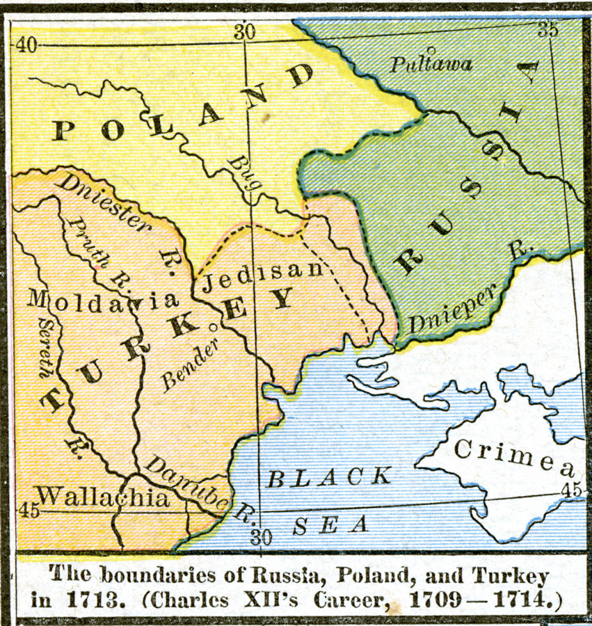
Description: A map of the boundaries of Russia, Poland, and Turkey in 1713, subtitled "Charles XII's Career, 1709–1714."
Place Names: Eastern Europe, Bavaria, �Belgium, �Bohemia, �Denmark, �England, �France, �Hungary, �Italy, �Poland, �Portugal, �Prussia, �Spain, �Switzerland, �Turkey, �United Kingdo
ISO Topic Categories: oceans,
location,
inlandWaters,
boundaries
Keywords: The Boundaries of Russia, Poland, and Turkey, borders, �political, country borders, oceans,
location,
inlandWaters,
boundaries, Unknown, 1709–1714
Source: Robert H. Labberton, New Historical Atlas and General History (New York, NY: Townsend MacCoun, 1886) Plate XLVII
Map Credit: Courtesy the private collection of Roy Winkelman |
|