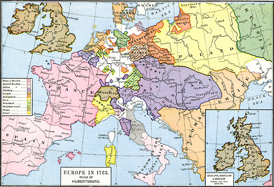
Description: A map of Europe subtitled "The Peace Hubertsburg" or Hubertusburg. The Treaty of Hubertusburg marked the end of the Seven Years' War, and this map shows country boundaries in 1763 under control of the House of Bourbon, the Spanish Bourbons, the Italian Bourbons, Habsburg, Guelphs, Hohenzollern, Savoy, Wittelsbach, the Palatinate Branch, Wettin, and Poland. The inset map shows England, Scotland, and Ireland during the 18th Century.
Place Names: A Complete Map of Europe, Bavaria, �Belgium, �Bohemia, �Brandenburg, �Denmark, �England, �France, �Hungary, �Ireland, �Italy, �Netherlands, �Poland, �Prussia, �Sicily, �Spain, �Switzerland, �United Kingdo
ISO Topic Categories: oceans,
location,
inlandWaters,
boundaries
Keywords: Europe, borders, �political, country borders, oceans,
location,
inlandWaters,
boundaries, Unknown, 1763
Source: Robert H. Labberton, New Historical Atlas and General History (New York, NY: Townsend MacCoun, 1886) Plate XLVIII
Map Credit: Courtesy the private collection of Roy Winkelman |
|