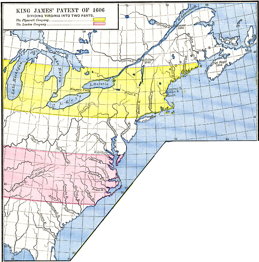
Description: A map of eastern North America showing the territory of the King James Patent of 1606. The map is color–coded to show the territory granted the Plymouth Company and the London Company by King James I of England, which divided the Virginia Territory into two parts. The map shows the rivers of the region, and the French settlements with dates given along the St. Lawrence and Norumbega, including Hochelaga (1542), Tadousac (1534), and Port Royal (1604) in Nova Scotia.
Place Names: A Regional Map of North America, Canada, �United State
ISO Topic Categories: oceans,
location,
inlandWaters
Keywords: King James' Patent, borders, �historical, historical event, oceans,
location,
inlandWaters, Unknown, 1606
Source: Robert H. Labberton, New Historical Atlas and General History (New York, NY: Townsend MacCoun, 1886) Plate LX
Map Credit: Courtesy the private collection of Roy Winkelman |
|