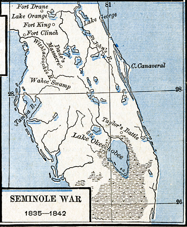
Description: A map of the Florida peninsula showing the forts and battle sites during the Second Seminole War (1835–1842), including the site of Dade's Massacre, Taylor's Battle, Fort Drane, Fort King, and the location of Fort Clinch at the time on the Withlacoochee River (moved to Amelia Island after the war).
Place Names: Growth of Nation, Fort Clinch, �Fort King, �Lake George, �Lake Okeechobee, �Tampa, �East Florid
ISO Topic Categories: oceans,
location,
inlandWaters
Keywords: Seminole War, borders, �historical, kNativeAmerican, other military, oceans,
location,
inlandWaters, Unknown, 1835–1842
Source: Robert H. Labberton, New Historical Atlas and General History (New York, NY: Townsend MacCoun, 1886) Plate LXVIII
Map Credit: Courtesy the private collection of Roy Winkelman |
|