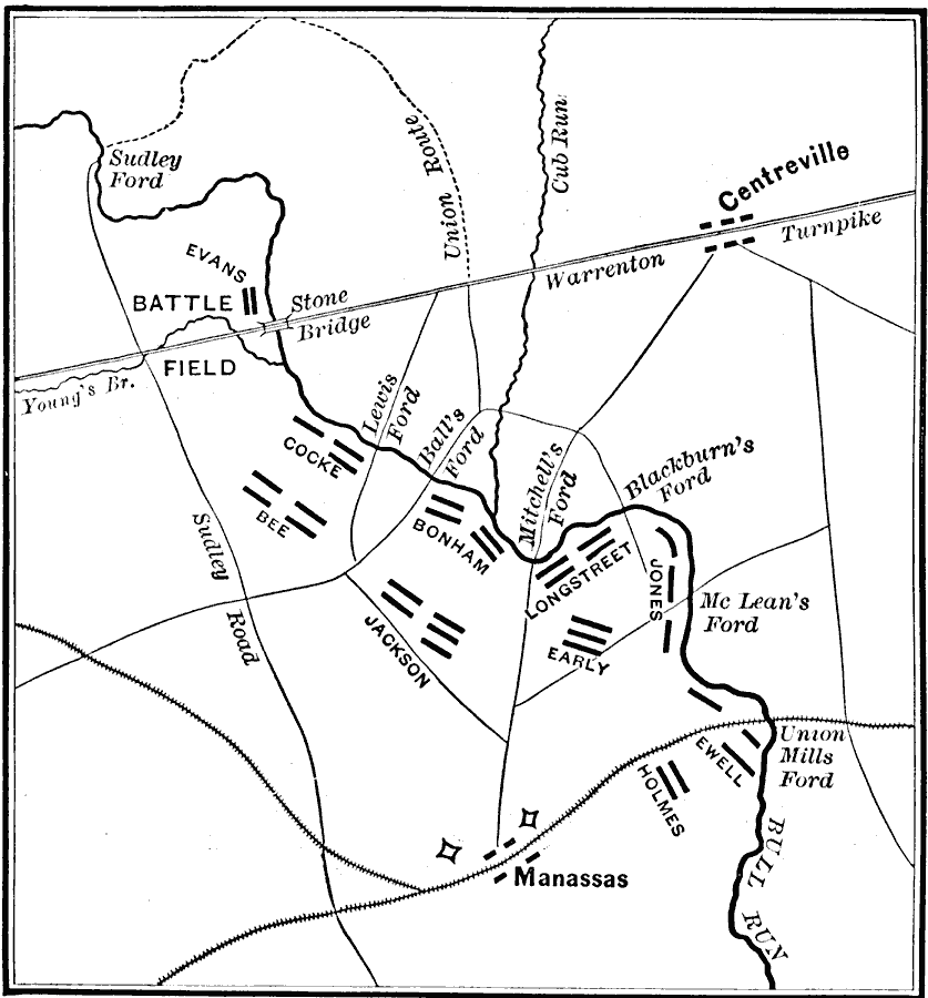
Description: A map of operations for the First Battle of Bull Run or First Battle of Manassas, the initial major land battle of the American Civil War, July 21, 1861. The map shows Bull Run Creek, the towns of Manassas, Centerville, the Stone Bridge, Warrenton Turnpike, Sudley Road, railroads, the strategic fords of Bull Run Creek, the route of the Union Army, and battle positions of Evens, Cocke, Bee, Bonham, Longstreet, Jackson, Early, Holms, and Ewell.
Place Names: Civil War, Manassas, �Bull Run, �Centrevill
ISO Topic Categories: location,
inlandWaters,
transportation,
intelligenceMilitary
Keywords: First Battle of Bull Run, physical, �historical, �transportation, kBattle, physical features, roads, Civil War, location,
inlandWaters,
transportation,
intelligenceMilitary, Unknown, July 21, 1861
Source: E. Benjamin Andrews, History of the United States (New York, NY: Charles Scribner's Sons, 1895) 351
Map Credit: Courtesy the private collection of Roy Winkelman |
|