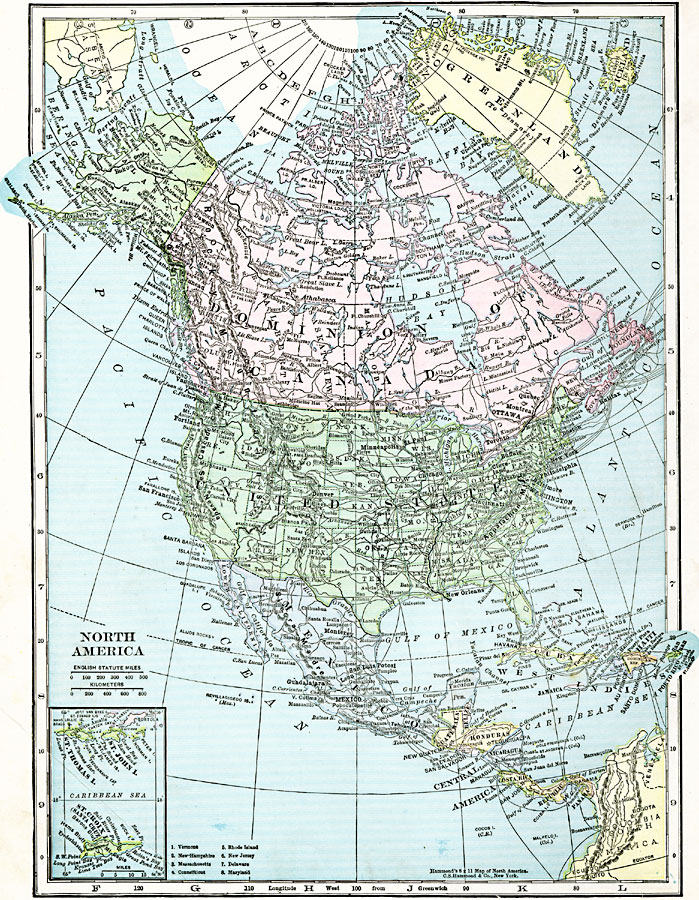
Description: A map from 1920 of North America, Central America, Greenland, and Caribbean showing national, state, and province boundaries, capitals and major cities, railroads, submarine telegraph cables, mountain systems, rivers, and coastal features. Inset maps detail the Caribbean islands of St. Thomas, St. John, and St. Croix.
Place Names: A Complete Map of North America, Bahamas, �Canada, �Central America, �Cuba, �Mexico, �United State
ISO Topic Categories: oceans,
location,
inlandWaters,
boundaries
Keywords: North America, political, major political subdivisions,
country borders, oceans,
location,
inlandWaters,
boundaries, Unknown, 1920
Source: , The New Reference Atlas of the World - A New Series of Physical, Political and Historical Maps compiled from Government Surveys and exhibiting the Latest Results of Geographical Research (New York, NY: C. S. Hammond & Company, 1920) 2
Map Credit: Courtesy the private collection of Roy Winkelman |
|