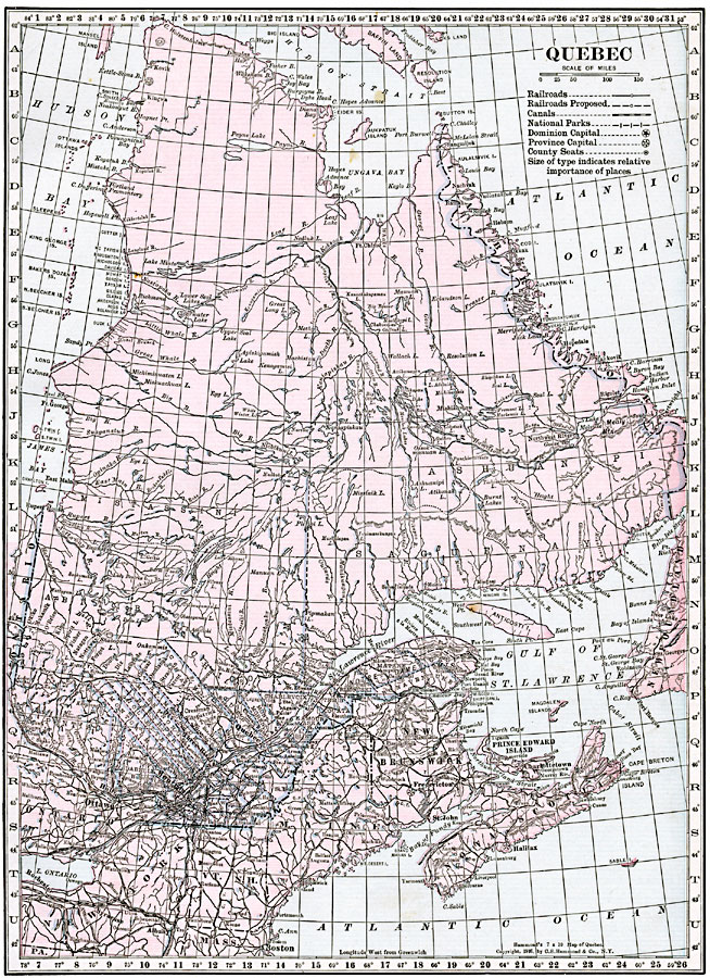
Description: A map from 1920 of the province of Quebec from the St. Lawrence River to Hudson Bay and the Hudson Strait. The map shows the Dominion capital of Ottawa, Province capital of Quebec City, major cities and towns, existing and proposed railways, canals, county boundaries and county seats, national park boundaries, lakes, the watershed division line (Height of Land), rivers, islands, and the Hudson Bay shoreline and coastal features of this portion of the province. The latitude and longitude grid is shown at one degree increments.
Place Names: Canada, Montreal, �Quebe
ISO Topic Categories: oceans,
location,
inlandWaters
Keywords: Province of Quebec, borders, �political, �transportation, country borders, railroads, oceans,
location,
inlandWaters, Unknown, 1920
Source: , The New Reference Atlas of the World - A New Series of Physical, Political and Historical Maps compiled from Government Surveys and exhibiting the Latest Results of Geographical Research (New York, NY: C. S. Hammond & Company, 1920) 5
Map Credit: Courtesy the private collection of Roy Winkelman |
|