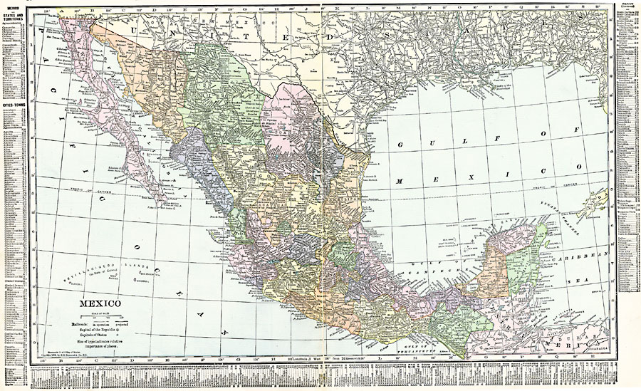
Description: A map from 1920 of Mexico showing the states and state capitals, major cities and towns, existing and proposed railroads, mountains, rivers, lakes, and coastal features of the country. A grid–key in the margin references the locations of states and territories, and principal cities and towns in Mexico.
Place Names: Mexico, Acapulco, �Cancun, �Chiapas, �Chihuahua, �Coahuila, �Durango, �Guadalajara, �Guerrero, �La Paz, �Merida, �Mexico City, �Monterrey, �Salina Cruz, �Sinaloa, �Sonora, �Tampico, �Tijuana, �Veracruz, �Yucata
ISO Topic Categories: oceans,
location,
inlandWaters
Keywords: Mexico, borders, �political, �transportation, country borders,
county borders, railroads, oceans,
location,
inlandWaters, Unknown, 1920
Source: , The New Reference Atlas of the World - A New Series of Physical, Political and Historical Maps compiled from Government Surveys and exhibiting the Latest Results of Geographical Research (New York, NY: C. S. Hammond & Company, 1920) 20-21
Map Credit: Courtesy the private collection of Roy Winkelman |
|