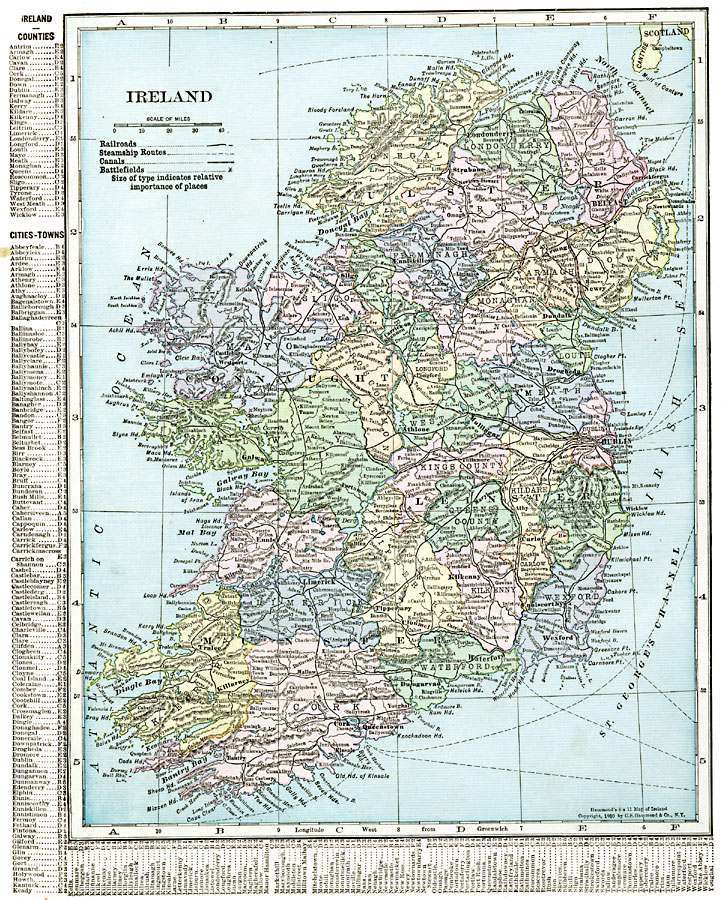
Description: A map of Ireland in 1920 showing major cities, ports, railroads, canals, steamship routes and historic battlefields. This map has a reference key to the Irish counties, cities, and towns.
Place Names: Ireland, Antrim, �Armagh, �Clare, �Connaught, �Cork, �Donegal, �Dublin, �Foynes, �Galway, �Killarney, �Leinster, �Limerick, �Londonderry, �Meath, �Monaghan, �Munster, �New Ross, �Shannon, �Sligo, �Tyrone, �Ulste
ISO Topic Categories: oceans,
location,
inlandWaters
Keywords: Ireland, borders, �political, �transportation, �historical, major political subdivisions,
county borders, railroads,
water routes, other military, oceans,
location,
inlandWaters, Unknown, 1920
Source: , The New Reference Atlas of the World - A New Series of Physical, Political and Historical Maps compiled from Government Surveys and exhibiting the Latest Results of Geographical Research (New York, NY: C. S. Hammond & Company, 1920) 40
Map Credit: Courtesy the private collection of Roy Winkelman |
|