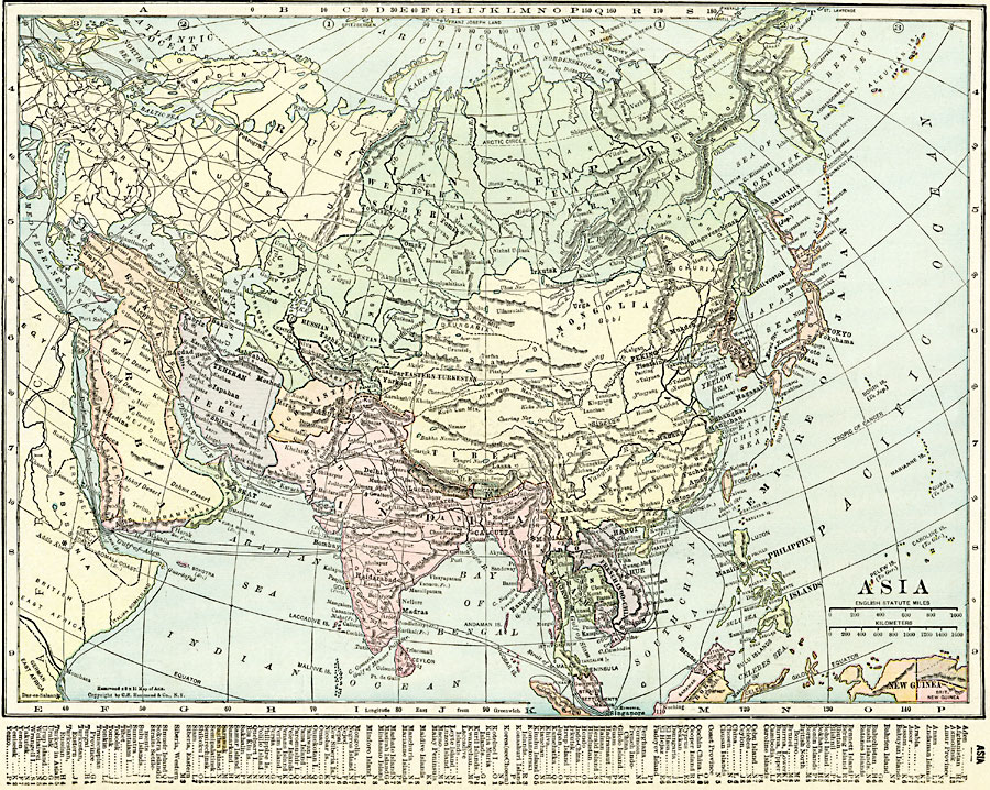
Description: A map of Asia from 1920 showing country boundaries at the time, foreign possessions, major cities, rivers, lakes, terrain, islands, and coastal features. This map shows the principal railways of the region with connections to Europe, and steamship trade routes. A grid key references countries, islands, and important locations on the map.
Place Names: A Complete Map of Asia, China, �Hanoi, �India, �Indonesia, �Japan, �Kazakhstan, �Mongolia, �Pakistan, �Phillipines, �Russia, �Siam, �Singapore, �Thailand, �Tibe
ISO Topic Categories: oceans,
location,
inlandWaters,
boundaries
Keywords: Asia, borders, �political, �transportation, country borders,
major political subdivisions, railroads,
water routes, oceans,
location,
inlandWaters,
boundaries, Unknown, 1920
Source: , The New Reference Atlas of the World - A New Series of Physical, Political and Historical Maps compiled from Government Surveys and exhibiting the Latest Results of Geographical Research (New York, NY: C. S. Hammond & Company, 1920) 53
Map Credit: Courtesy the private collection of Roy Winkelman |
|