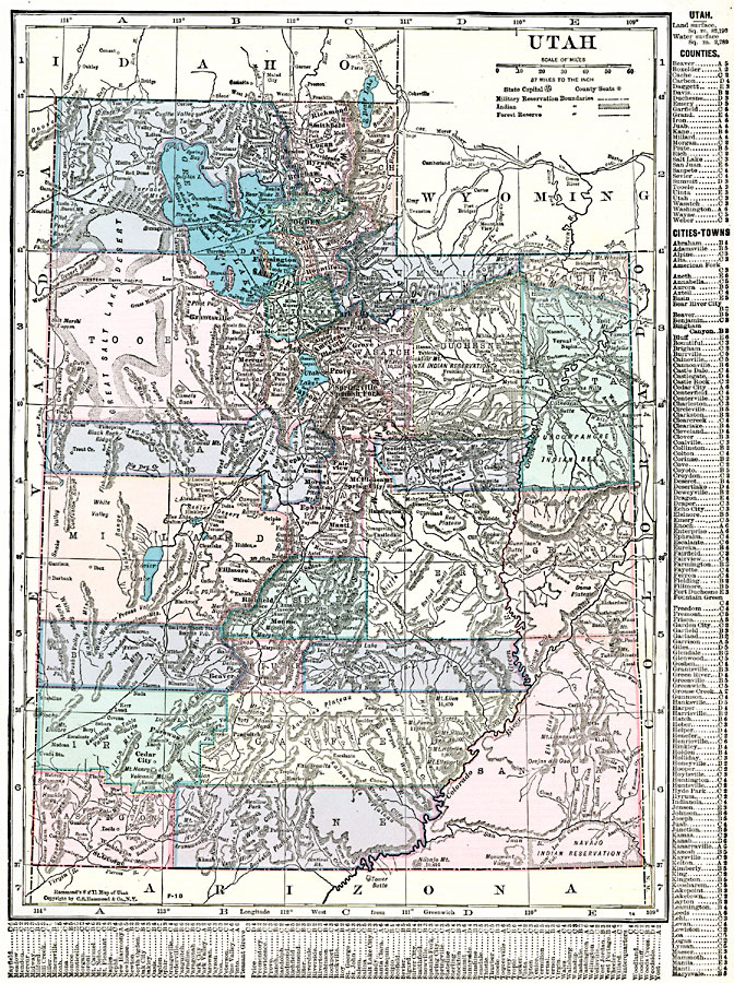
Description: A map from 1920 of Utah showing the capital at Salt Lake City, counties and county seats, principal cities and towns, Indian reservations, forest reserves, military reservations, railroads, mountains, lakes, rivers, and the Great Salt Lake Desert region to the west of Salt Lake. A grid reference in the margins of the map lists counties, principal cities, and towns of Utah.
Place Names: Utah, Brigham, �Corinne, �Deseret, �Eureka, �Murray, �Ogden, �Parowan, �Provo, �Salt Lake City, �St. Georg
ISO Topic Categories: oceans,
location,
inlandWaters,
boundaries
Keywords: Utah, borders, �political, �physical, �statistical, kNativeAmerican, county borders, ethnological, oceans,
location,
inlandWaters,
boundaries, Unknown, 1920
Source: , The New Reference Atlas of the World - A New Series of Physical, Political and Historical Maps compiled from Government Surveys and exhibiting the Latest Results of Geographical Research (New York, NY: C. S. Hammond & Company, 1920) 117
Map Credit: Courtesy the private collection of Roy Winkelman |
|