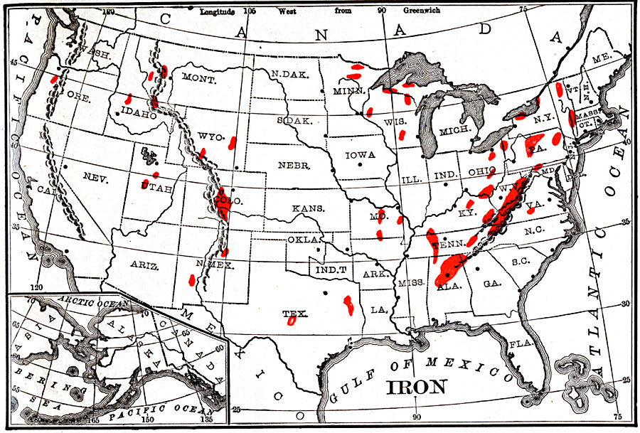
Description: Iron ore mining regions of the United States.
Place Names: Minerals, iron or
ISO Topic Categories: boundaries,
economy,
inlandWaters,
location,
oceans,
geoscientificInformation
Keywords: Iron Mining, physical, �statistical, kResources, physical features, industry, boundaries,
economy,
inlandWaters,
location,
oceans,
geoscientificInformation, Unknown, 1904
Source: Alexis Everett Frye, Elements of Geography (Boston, MA: Ginn and Company, 1904) 77
Map Credit: Courtesy the private collection of Roy Winkelman |
|