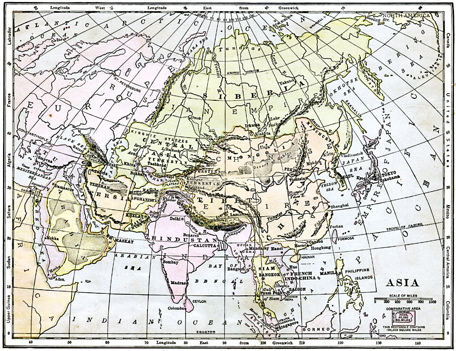
Description: A map of Asia from 1904 showing country boundaries at the time, major cities, rivers, lakes, deserts, terrain, and coastal features. This map shows the extent of the Russian Empire and Turkish Ottoman Empire in Asia, the Empire of Japan and Chinese Republic, foreign possessions, and the Great Wall of China. Relative latitudes for other regions of the world are shown in the side margins, and an outline map of Pennsylvania at the same map scale is included to show comparative area size.
Place Names: A Complete Map of Asia, China, �Mongolia, �Siberia, �Russian Empire, �Korea, �Empire of Japan,�Tibet, �Siam, �French Indo-China, �Hindustan, �Persia, �Arabia,
ISO Topic Categories: inlandWaters,
location,
oceans,
boundaries
Keywords: Asia, physical, �political, kComparativeArea, physical features, country borders, inlandWaters,
location,
oceans,
boundaries, Unknown, 1904
Source: Alexis Everett Frye, Elements of Geography (Boston, MA: Ginn and Company, 1904) 89
Map Credit: Courtesy the private collection of Roy Winkelman |
|