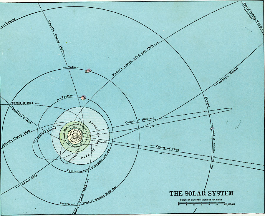
Description: Map of the Solar System. Map shows planets' position and length of orbit relative to the Sun. Also shows the dates and paths of various comets.
Place Names: A Regional Map of Astronomical, Earth, �Jupiter, �Mars, �Mercury, �Neptune, �Saturn, �Sun, �Uranus, �Venus,
ISO Topic Categories: location
Keywords: The Solar System, orbit, �position, �physical, location, Unknown, 1920
Source: , The New Reference Atlas of the World - A New Series of Physical, Political and Historical Maps compiled from Government Surveys and exhibiting the Latest Results of Geographical Research (New York, NY: C. S. Hammond & Company, 1920) 128
Map Credit: Courtesy the private collection of Roy Winkelman |
|