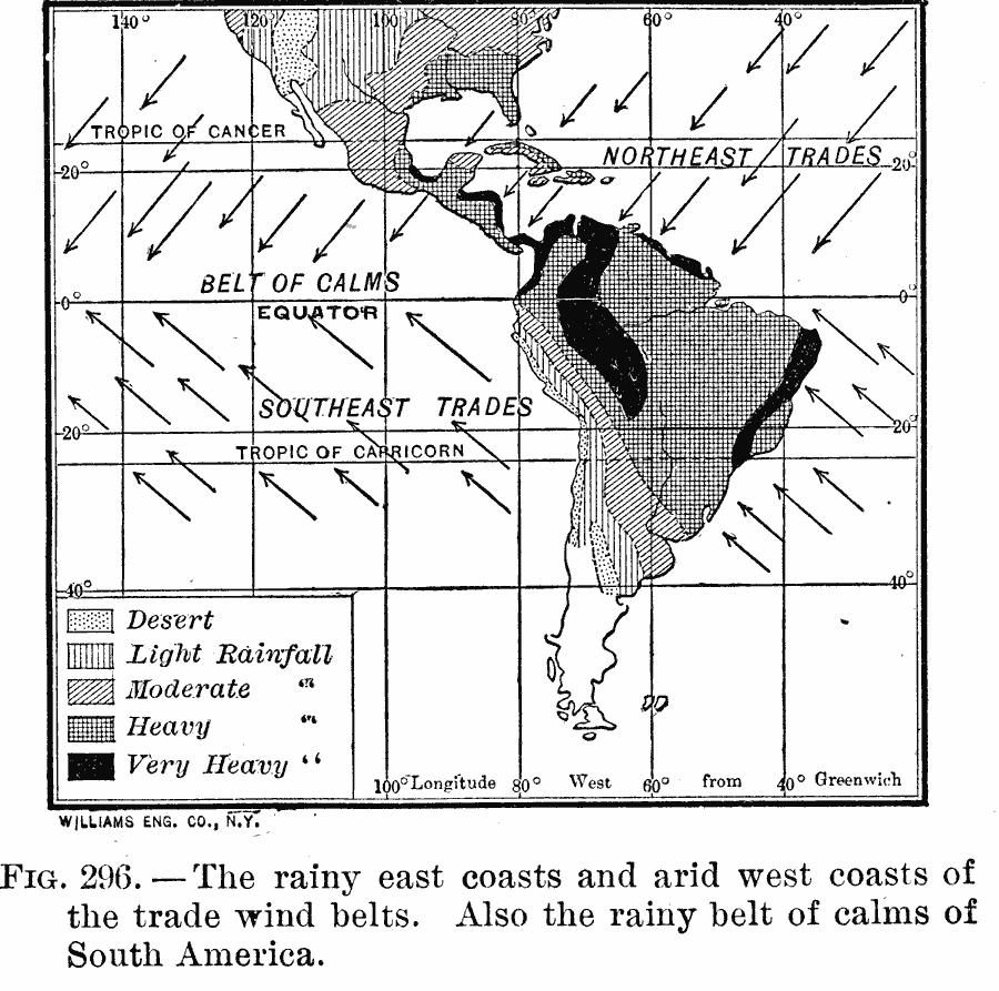
Description: A map of South America from 1910 showing the effect of winds on rainfall. The map shows the direction of prevailing winds, and the rainy east coasts and arid west coasts of the trade wind belts. The map is shaded to show areas of desert, and areas where mean annual rainfall is from light to very heavy. The map includes the Central America region and southern portion of North America.
Place Names: A Complete Map of South America, North America, �South Americ
ISO Topic Categories: climatologyMeteorologyAtmosphere
Keywords: Rain Patterns and the Trade Winds of South America, meteorological, kClimate, winds,
rainfall, climatologyMeteorologyAtmosphere, Unknown, 1910
Source: Ralph S. Tarr, B.S., F.G.S.A. and Frank M. McMurry, Ph.D., New Geographies (Second Book) (New York , NY: The MacMillan Company, 1910) 211
Map Credit: Courtesy the private collection of Roy Winkelman |
|