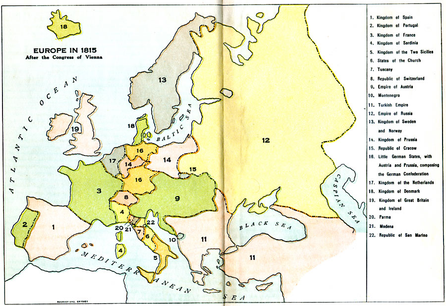
Description: A colored outline map of Europe in 1815, after the Congress of Vienna. Territories are numbered and referenced on the map.
Place Names: A Complete Map of Europe, Kingdom of Spain, Kingdom of Portugal, Kingdom of France, Kingdom of Sardinia, Kingdom of the Two Sicilies, States of the Church, Tuscany, Republic of Switzerland, Empire of Austria, Montenegro, Turkish Empire, Empire of Russia, Kingdom of Sweden and Norway, Kingdom of Prussia, Republic of Cracow, Little German States, German Confederation, Kingdom of the Netherlands, Kingdom of Denmark, Kingdom of Great Briton and Ireland, Parma, Modena, Republic of San Marino
ISO Topic Categories: boundaries,
oceans
Keywords: Europe, physical, �political, �historical, physical features, country borders, boundaries,
oceans, Unknown, 1815
Source: L. P. Benezet, The Story of the Map of Europe (Chicago, Illinois: Scott, Foresman and Company, 1916) 130-131
Map Credit: Courtesy the private collection of Roy Winkelman |
|