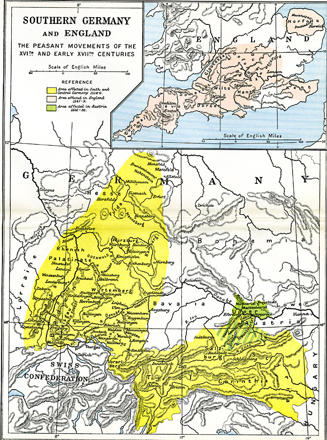
Description: A map showing Southern Germany and England during the Peasant Wars, subtitled "The Peasant Movements of the 16th and early 17th Centuries." The map is color–coded to indicate the area affected by the peasant movement (revolt) in southern and central Germany in 1524–1526, southern England in 1547–1549, and in Austria in 1626–1636. The map shows important cities during this period.
Place Names: Western and Central Europe, Austria, �Cornwall, �Dorset, �England, �Germany, �Gloucester, �Hants, �Hesse, �Innsbruck, �Oxford, �Rhenish, �Somerset, �United Kingdom, �Wurtembur
ISO Topic Categories: oceans,
location,
inlandWaters
Keywords: Southern Germany and England, historical, �political, country borders,
major political subdivisions,
local jurisdictions, historical event, oceans,
location,
inlandWaters, Unknown, 1524–1636
Source: Ward, Prothero, and Leathes, The Cambridge Modern History Atlas (New York, NY: The Macmillan Company, 1912)
Map Credit: Courtesy the private collection of Roy Winkelman |
|