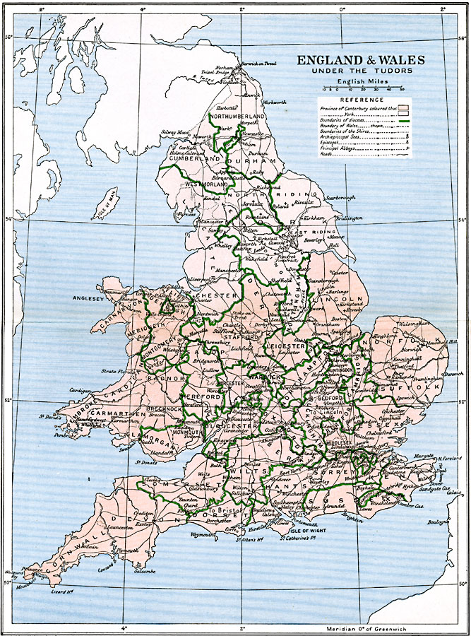
Description: A map of England and Wales under the Tudors (1485–1603). This map is color–coded to show the two ecclesiastical provinces of the Church of England, the Province of York in the north, and the Province of Canterbury in the south. The boundaries of the dioceses and shires are shown, as well as the boundary between Wales and England. The Archiepiscopal Sees, churches, and abbeys are shown, and major cities and roads.
Place Names: United Kingdom, Bristol, �Dundee, �Edinborough, �Falmouth, �Glasgow, �London, �Londonderry, �Manchester, �Newcastle, �Plymout
ISO Topic Categories: oceans,
location,
inlandWaters,
boundaries
Keywords: England and Wales under the Tudors, political, country borders,
major political subdivisions,
local jurisdictions, oceans,
location,
inlandWaters,
boundaries, Unknown, 1485–1603
Source: Ward, Prothero, and Leathes, The Cambridge Modern History Atlas (New York, NY: The Macmillan Company, 1912)
Map Credit: Courtesy the private collection of Roy Winkelman |
|