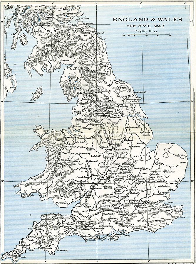
Description: A map of England, Wales, and southern Scotland between (1642–1651) subtitled "The Civil War." The map shows several important battlefields of the wars, including Powick Bridge, Edgehill, Ardwalton Moor, Chalgrove, Braddock Down, Hopton Heath, Roundaway Down, Gainsborough, Newbury, Winceby, Marston Moor, Cropredy Bridge, Lostwhithiel, Tippermuir, Naseby, Rowtown Heath, and Langport (First Civil War), St. Fagan's, Maidstone, and Preston (Second Civil War), Dunbar and Edinburgh (Third Civil War).
Place Names: United Kingdom, England, �London, �Newcastle, �Plymouth, �United Kingdom, �Wales,
ISO Topic Categories: oceans,
location,
inlandWaters,
boundaries
Keywords: England and Wales , political, �historical, local jurisdictions,
country borders,
major political subdivisions, other military, oceans,
location,
inlandWaters,
boundaries, Unknown, 1642–1651
Source: Ward, Prothero, and Leathes, The Cambridge Modern History Atlas (New York, NY: The Macmillan Company, 1912)
Map Credit: Courtesy the private collection of Roy Winkelman |
|