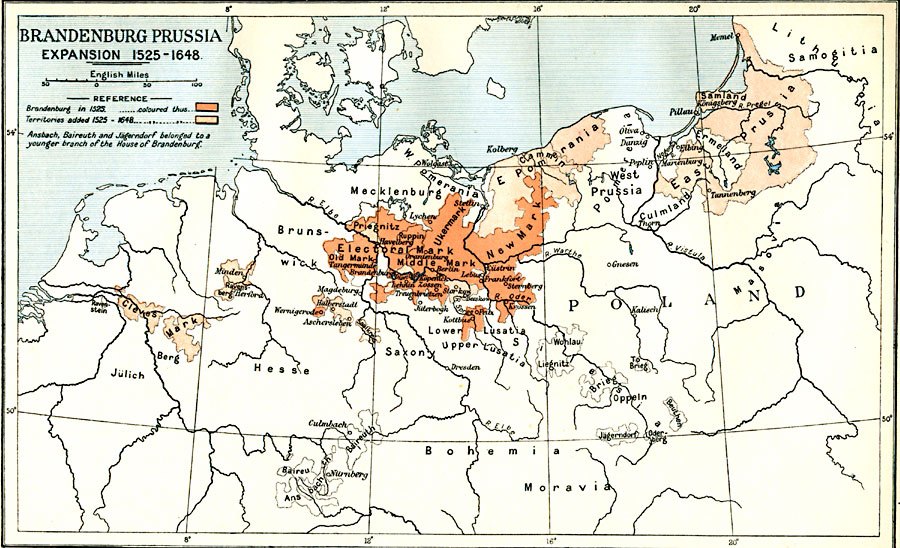
Description: Map of Brandenburg Prussia, subtitled "Expansion 1525–1648." The map is color–coded to highlight the original Brandenburg lands in 1525, and the territories added from 1525 to 1648.
Place Names: Germany, Bohemia, �Brandenburg, �Mecklenburg, �Moravia, �Pomerania, �Prussi
ISO Topic Categories: oceans,
location,
inlandWaters,
boundaries
Keywords: Brandenburg Prussia, political, �historical, local jurisdictions,
country borders,
major political subdivisions, historical event,
other military, oceans,
location,
inlandWaters,
boundaries, Unknown, 1525–1648
Source: Ward, Prothero, and Leathes, The Cambridge Modern History Atlas (New York, NY: The Macmillan Company, 1912)
Map Credit: Courtesy the private collection of Roy Winkelman |
|