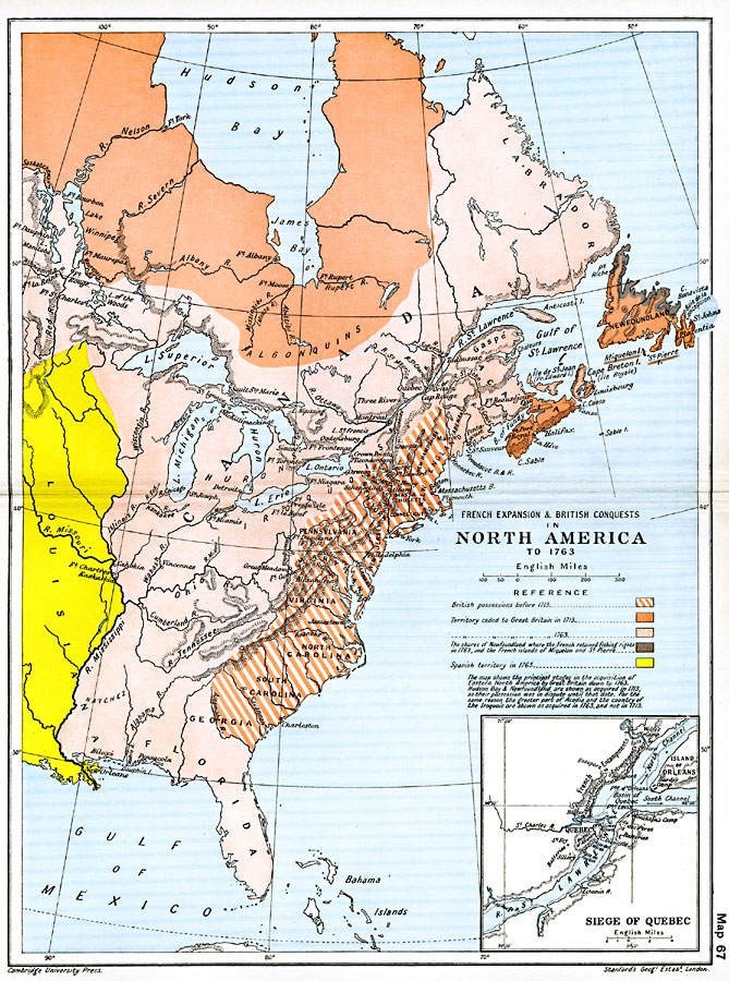
Description: A map of eastern North America showing the British and French territorial expansion in the region between 1700 and the end of the French and Indian War in 1763. The map shows the principal stages in the acquisition of Eastern North America by Great Britain down to 1763. Hudson Bay and Newfoundland are shown as acquired in 1713, as their possession was in dispute until that date. For the same reason the greater part of Acadia and the country of the Iroquois are shown as acquired in 1763, and not in 1713. The map is color–coded to show the British possessions before 1713, the territory ceded to Great Britain in 1713 and 1763, the shores of Newfoundland where the French retained fishing rights in 1763, and the French islands of Miquelon and St. Pierre, and the Spanish territory in 1763. The inset map details the Siege of Quebec on the St. Lawrence, showing the walled city, the Heights of Abraham, The French encampments, entrenchments, and batteries, and the British camps of Monckton and Hardy.
Place Names: A Regional Map of North America, Bahamas, �Canada, �Cuba, �Mexico, �United State
ISO Topic Categories: oceans,
location,
inlandWaters,
boundaries
Keywords: French Expansion and British Conquests in North America , political, �historical, local jurisdictions,
country borders,
major political subdivisions, other military,
historical event, oceans,
location,
inlandWaters,
boundaries, Unknown, 1700–1763
Source: Ward, Prothero, and Leathes, The Cambridge Modern History Atlas (New York, NY: The Macmillan Company, 1912)
Map Credit: Courtesy the private collection of Roy Winkelman |
|