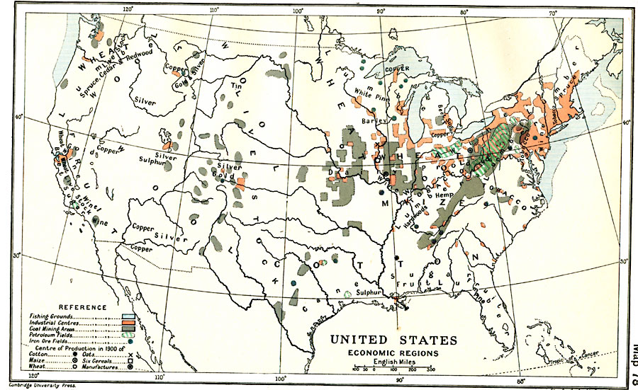
Description: A map from 1912 of the United States showing the principal industries of the region. The map is color–coded to show the areas of fishing grounds, industrial centers, coal mining areas, petroleum fields, and iron ore fields. This map shows the centers of production in 1900 for cotton, maize, wheat, oats, six cereals, and manufactures, and shows the general areas of agricultural production (wheat, livestock, wool, cotton, fruit, wine, and tobacco), forestry (lumber, hardwoods, pine, spruce, cedar, and redwood), and mining (gold, silver, copper, and sulphur).
Place Names: Industry, economic regions, �fishing, �industrial centers, �coal mining areas, �petroleum fields, �iron ore field
ISO Topic Categories: oceans,
location,
inlandWaters,
transportation
Keywords: United States Economic Regions, physical, �statistical, kIndustry, geological, economic,
industry, oceans,
location,
inlandWaters,
transportation, Unknown, 1900
Source: Ward, Prothero, and Leathes, The Cambridge Modern History Atlas (New York, NY: The Macmillan Company, 1912)
Map Credit: Courtesy the private collection of Roy Winkelman |
|