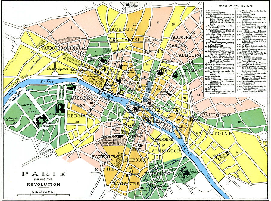
Description: A map of Paris at the time of the French Revolution (1789–1799), showing important landmarks of the period, including the Bastille, Hôtel de Ville, Palais Royal, Louvre, and Champ de Mars, with a numbered reference key to sections of the city. The map is color–coded to show different parts of city, including the individual Faubourgs (suburbs).
Place Names: France, Pari
ISO Topic Categories: oceans,
location,
inlandWaters,
boundaries
Keywords: Paris during the Revolution, political, �transportation, country borders,
major political subdivisions,
local jurisdictions,
county borders, roads, oceans,
location,
inlandWaters,
boundaries, Unknown, 1789–1799
Source: Ward, Prothero, and Leathes, The Cambridge Modern History Atlas (New York, NY: The Macmillan Company, 1912)
Map Credit: Courtesy the private collection of Roy Winkelman |
|