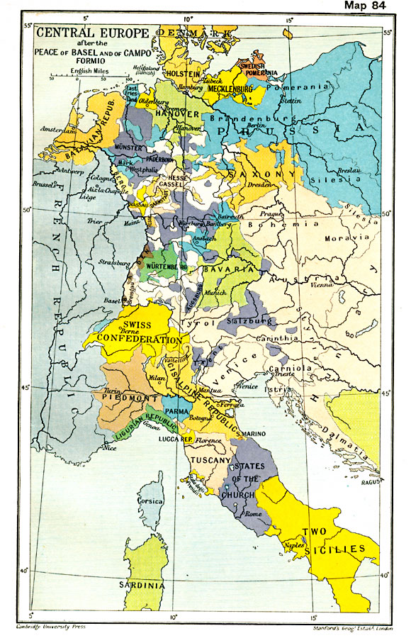
Description: A map showing Central Europe after the Peace of Basel and of Campo Formio, including the countries of Denmark–Holstein, Swedish Pomerania, East Friesland, Oldenburg, Hanover, Batavian Republic, Westphalia, Berg, Hesse Cassel, Nassau, Darmstadt, Saxony, Bohemia, Austria, Bavaria, Salzburg, Würtemburg, Baden, Augsburg, Swiss Confederation, Piedmont, Cisalpine Republic, Parma, Ligurian Republic, Lucca Republic, Trent, Venice, Carthinia, Carniola, Istria, Dalmatia, Tuscany, Stato degili Presidii, States of the Church, Corsica, Sardinia, the Two Sicilies, and portions of Prussia, French Republic, Hungary, and the Ottoman Empire in Europe.
Place Names: Western and Central Europe, Bavaria, �Denmark, �France, �Hanover, �Hungary, �Prussia, �Salzburg, �Switzerland, �Tuscany, �Venice, �Wurtembur
ISO Topic Categories: oceans,
location,
inlandWaters
Keywords: Central Europe after the Peace of Basel and of Campo Formio, political, country borders,
major political subdivisions,
local jurisdictions, oceans,
location,
inlandWaters, Unknown, 1795
Source: Ward, Prothero, and Leathes, The Cambridge Modern History Atlas (New York, NY: The Macmillan Company, 1912)
Map Credit: Courtesy the private collection of Roy Winkelman |
|