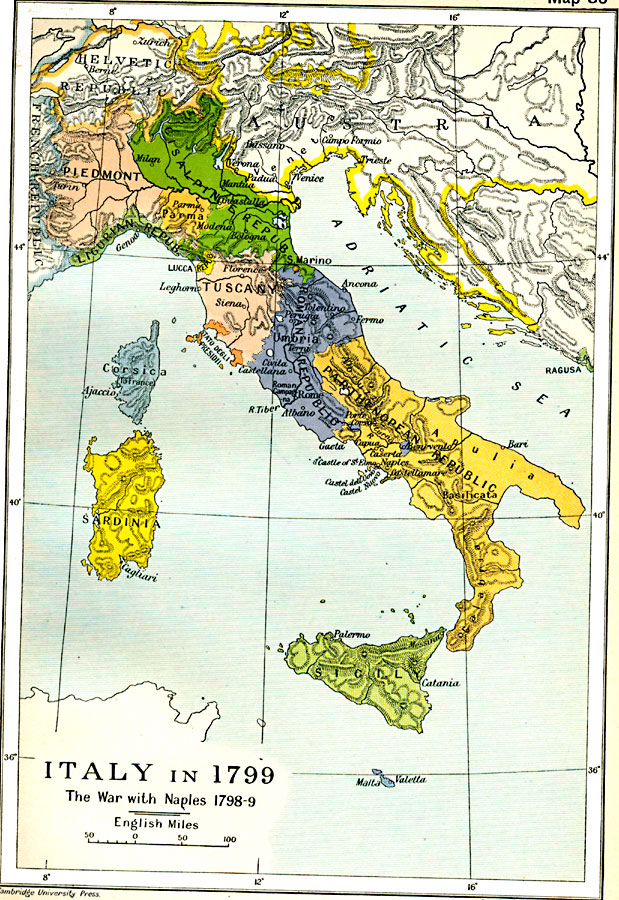
Description: Map of Italy in 1799, subtitled "The War with Naples 1798–9." The map shows Italy at the time when the Kingdom of Naples briefly became the French–supported Parthenopaean Republic from January to June, 1799. The map shows the territory of the Parthenopaean Republic, as well as the independent territories of Sicily, Malta, Sardinia, Corsica, Piedmont, Cisalpine Republic, Parma, Ligurian Republic, Lucca Republic, Tuscany, San Marino, Stato degli Presidii, and the Roman Republic. The map also shows the Helvetic Republic (Switzerland) and a portion of Austria that included the former territory of Venice. This map shows major cities, rivers, and mountain systems.
Place Names: Italy, Calabria, �Cisalpine Republic, �Corsica, �Piedmont, �Sardinia, �Sicily, �Tuscany, �Umbri
ISO Topic Categories: oceans,
location,
inlandWaters,
boundaries
Keywords: Italy during the War with Naples , political, �historical, kFrenchRevolution, country borders,
major political subdivisions,
local jurisdictions, other military, oceans,
location,
inlandWaters,
boundaries, Unknown, 1798–1799
Source: Ward, Prothero, and Leathes, The Cambridge Modern History Atlas (New York, NY: The Macmillan Company, 1912)
Map Credit: Courtesy the private collection of Roy Winkelman |
|