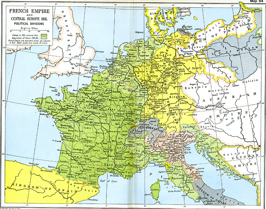
Description: A map showing the French Empire and Central Europe in 1811, subtitled "Political Divisions." This map is color–coded to show France at the time of the French Revolution in 1789 in dark green, and territories acquired between 1789 and 1811 under Napoleon Bonaparte in light green. The map shows country borders and territorial subdivisions, including the 83 French departments created during the revolution, and the German states of the Confederation of the Rhine. The map shows major rivers and important cities of the time.
Place Names: Western and Central Europe, Denmark, �England, �France, �Great Britain, �Italy, �Prussia, �Spain, �Switzerland, �Andorra
ISO Topic Categories: oceans,
location,
inlandWaters,
boundaries
Keywords: French Empire and Central Europe, political, �historical, kNapoleonBonaparte, kNapoleonicWars, country borders,
major political subdivisions,
local jurisdictions, historical event,
other military, oceans,
location,
inlandWaters,
boundaries, Unknown, 1789–1811
Source: Ward, Prothero, and Leathes, The Cambridge Modern History Atlas (New York, NY: The Macmillan Company, 1912)
Map Credit: Courtesy the private collection of Roy Winkelman |
|