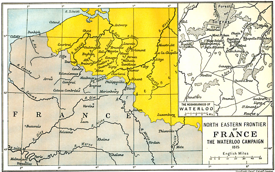
Description: A map of the northeastern frontier of France with Belgium and the Netherlands at the time of Napoleon's return to power and the War of the Seventh Coalition, subtitled "The Waterloo Campaign 1815." The map is color–coded to highlight boundary between countries, and shows important cities of the region, including Paris and Antwerp. The inset map details the environs of Waterloo, including Ligny, Quatre Bras, Mont Saint Jean, and the Forest of Soignes.
Place Names: France, Antwerp, �Beauvais, �Calais, �Chalons, �Luxemburg, �Paris, �Rheims, �Verdun, �Versailles, �Waterlo
ISO Topic Categories: oceans,
location,
inlandWaters,
boundaries
Keywords: North Eastern Frontier of France and Waterloo, political, �historical, kNapoleonBonaparte, kNapoleonicWars, country borders,
major political subdivisions,
local jurisdictions, historical event,
other military, oceans,
location,
inlandWaters,
boundaries, Unknown, 1815
Source: Ward, Prothero, and Leathes, The Cambridge Modern History Atlas (New York, NY: The Macmillan Company, 1912)
Map Credit: Courtesy the private collection of Roy Winkelman |
|