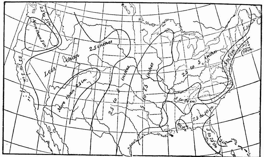
Description: A map from 1896 of the United States showing the areas of heaviest daily rainfalls given in inches.
Place Names: Meteorology, rainfal
ISO Topic Categories: climatologyMeteorologyAtmosphere,
inlandWaters,
oceans
Keywords: Heaviest Rainfalls, physical, �meteorological, kClimate, kPrecipitation, physical features, rainfall, climatologyMeteorologyAtmosphere,
inlandWaters,
oceans, Unknown, 1896
Source: Frank Waldo, Elementary Meteorology (New York, NY: American Book Company, 1896) 343
Map Credit: Courtesy the private collection of Roy Winkelman |
|