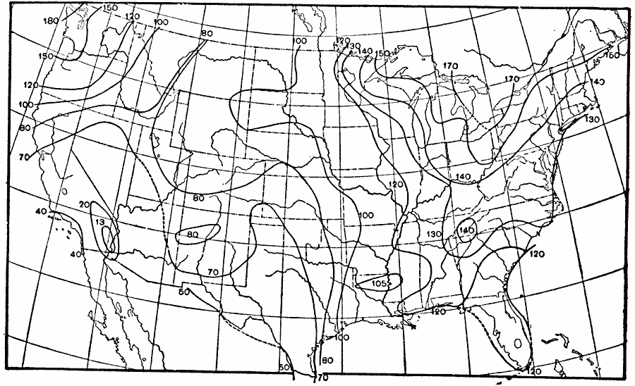
Description: A map from 1896 of the United States showing the mean number of days during the year with precipitation, including rainfall and snowfall.
Place Names: Meteorology, precipitatio
ISO Topic Categories: climatologyMeteorologyAtmosphere,
inlandWaters,
oceans
Keywords: Days with Precipitation, physical, �meteorological, kClimate, physical features, rainfall, climatologyMeteorologyAtmosphere,
inlandWaters,
oceans, Unknown, 1896
Source: Frank Waldo, Elementary Meteorology (New York, NY: American Book Company, 1896) 346
Map Credit: Courtesy the private collection of Roy Winkelman |
|