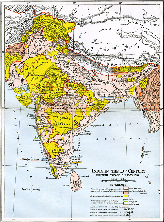
Description: A map of India in the 19th Century, subtitled "British Expansion 1805–1910." This map is color–coded to show native territories and states, British India in 1805, territories gained by Britain between 1805 and 1856, territories added between 1856 and 1910, the possessions or stations of France and Portugal, and the possessions of the Netherlands until 1845. The boundaries of provinces in India in 1910 are shown outlined in dark orange. Major cities, rivers, terrain and coastal features of the region are shown.
Place Names: India , Ahmadabad, �Bangalore, �Cochin, �Kandia, �Kanpur, �Kolkata, �Mumbai, �Nagpur, �New Delhi, �Panaj
ISO Topic Categories: oceans,
location,
inlandWaters,
boundaries
Keywords: India in the 19th Century, political, �historical, country borders,
local jurisdictions,
major political subdivisions, historical event, oceans,
location,
inlandWaters,
boundaries, Unknown, 1805–1910
Source: Ward, Prothero, and Leathes, The Cambridge Modern History Atlas (New York, NY: The Macmillan Company, 1912)
Map Credit: Courtesy the private collection of Roy Winkelman |
|