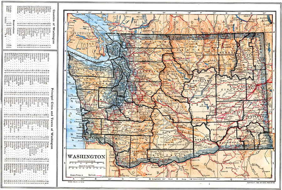
Description: A map from 1914 of Washington showing the capital, Olympia, counties and county seats, principal cities and towns, Indian reservations, railroads, mountains, lakes, rivers, and coastal features of the Puget Sound and Pacific. A grid reference in the margin of the map lists counties, principal cities, and towns of Washington.
Place Names: Washington, Seattle, �Spokane, �Tacoma, �Walla Walla, �Olympia, �Bellingham, �Everett, �North Yakima, �Tumwate
ISO Topic Categories: boundaries,
inlandWaters,
location,
oceans,
transportation
Keywords: Washington, physical, �political, �transportation, kNativeAmerican, physical features, county borders, railroads, boundaries,
inlandWaters,
location,
oceans,
transportation, Unknown, 1914
Source: , The New Encyclopedic Atlas and Gazetteer of the World (New York, NY: P. F. Collier and Son, 1914) 53
Map Credit: Courtesy the private collection of Roy Winkelman |
|