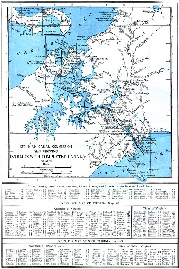
Description: A map from 1914 of the completed canal across the Isthmus of Panama. The map shows the Caribbean Sea entrance at Colon, the route of the canal through Gutan Lake and lock system, the Pacific entrance at the city of Panama, the Canal Zone boundary with the Republic of Panama, the continental divide, railroads, cities and towns, mountains, islands, and coastal features. An inset map shows the entire isthmus and country of Panama, from the border with Nicaragua to the border with Columbia. A grid–key at the bottom of the map references the locations of cities, towns, locks, stations, lakes, rivers, and islands in the Panama Canal Zone.
Place Names: Panama Canal Zone, Colon, �Cristobal, �Panam
ISO Topic Categories: boundaries,
location,
inlandWaters,
oceans,
transportation
Keywords: Isthmus with Completed Panama Canal, physical, �transportation, physical features, water routes, boundaries,
location,
inlandWaters,
oceans,
transportation, Unknown, 1914
Source: , The New Encyclopedic Atlas and Gazetteer of the World (New York, NY: P. F. Collier and Son, 1914) 66
Map Credit: Courtesy the private collection of Roy Winkelman |
|