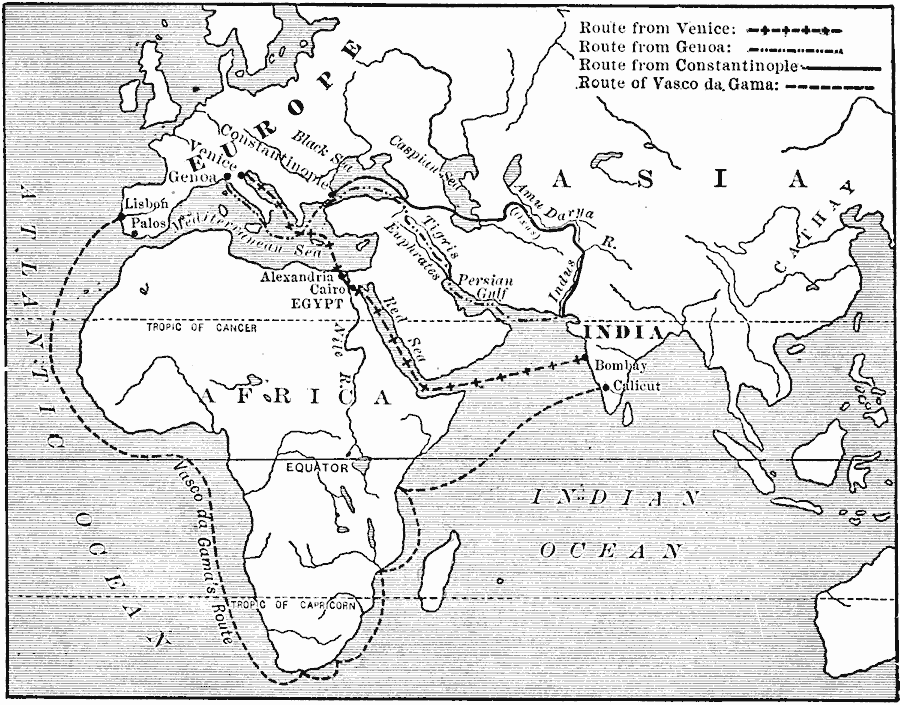
Description: A map of southern Europe, Africa, and India showing the chief trade routes from Europe to India. This map shows the route from Venice to Alexandria, through the Red Sea, to Bombay (Mumbai) on the western coast of India, the route from Genoa to Constantinople, by way of the Black Sea, the Tigris and Euphrates, to the Persian Gulf, and the coast of India, and the route from Constantinople and the Black Sea, across to the Caspian Sea, up the Amu Darya River (or Oxus), to the Indus River. After the Turks captured Constantinople (1453) and the eastern Mediterranean coastline, the old trade routes were blockaded, forcing an alternative route to India. The map shows the route of the Portuguese under Vasco de Gama from Lisbon, around the Cape of Good Hope to Calicut, India in 1497.
Place Names: Regional Miscellaneous, Africa, �Asia, �Europ
ISO Topic Categories: transportation, kWorldMedSea, kWorldEurasia, kWorldEuroAfrica, kWorldAtlantic, kWorldIndian
Keywords: Trade Routes between Europe and India, transportation, water routes, transportation, kWorldMedSea, kWorldEurasia, kWorldEuroAfrica, kWorldAtlantic, kWorldIndian, Unknown, AD 1000–1497
Source: Jacques W. Redway. F.R.G.S., The Redway School History (New York, NY: Silver, Burdett and Company, 1911) 5
Map Credit: Courtesy the private collection of Roy Winkelman |
|