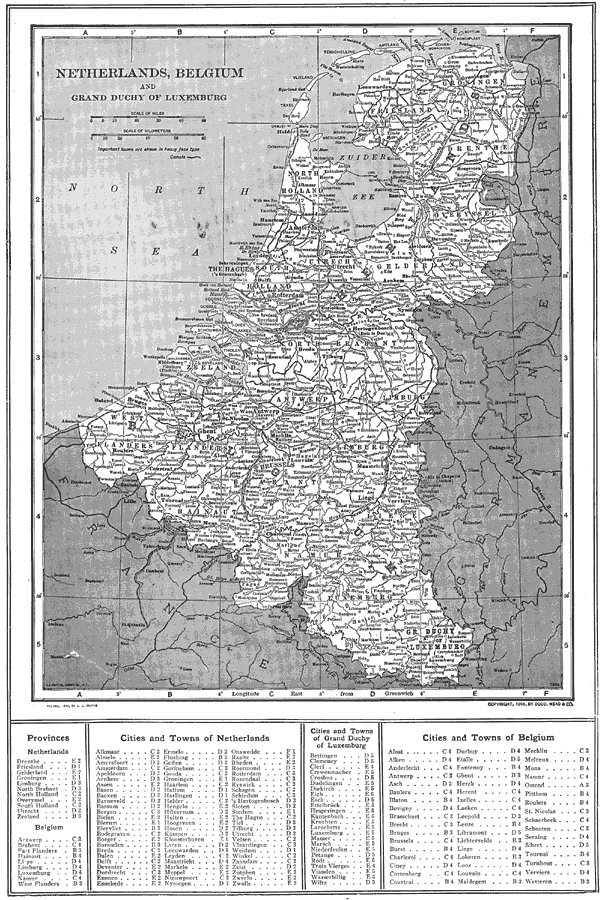
Description: A map of the Netherlands, Belgium, and the Grand Duchy of Luxemburg in 1914, showing province boundaries, major cities and ports, railroads, canals, rivers and hilly areas of the region. This map has a reference key to the provinces, cities, and towns of the Netherlands, Belgium, and Luxemburg at the bottom of the map.
Place Names: Low Countries, Antwerp, �Brussels, �Gent, �Mons, �Namur, �Amsterdam, �Utrecht, �Haarlem, �Rotterdam, �Dordrecht, �Assen, �Tilburg, �Zwolle, �Hague, �Ghent, ��Luxemburg, �Diekirch, �Esch, �Troisvierge
ISO Topic Categories: boundaries,
inlandWaters,
location,
transportation
Keywords: Netherlands, Belgium, and Grand Duchy of Luxemburg, physical, �political, �transportation, physical features, country borders, water routes, boundaries,
inlandWaters,
location,
transportation, Unknown, 1914
Source: , The New Encyclopedic Atlas and Gazetteer of the World (New York, NY: P. F. Collier and Son, 1914) 135
Map Credit: Courtesy the private collection of Roy Winkelman |
|