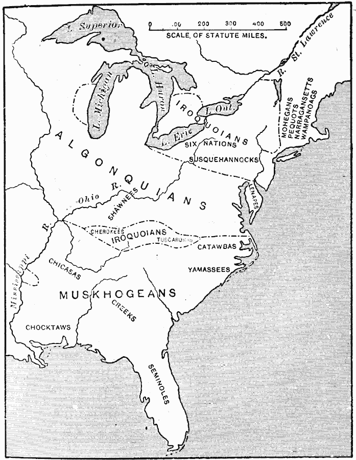
Description: A map from 1911 of eastern North America showing the general areas of early contact between the Native Americans and European settlers. The map is divided by groups (Algonquians, Iroquoians, Siouans, and Muskhogeans) and the principal representative tribes within the subdivisions, including the Mohegans, Pequots, Narragansetts, Wampanoags, Lenapes, Six Nations (Oneidas, Senecas, Cayugas, Onondagas, Mohawks, Tuscaroras), Susquehannocks, Shawnees, Cherokees, Catawbas, Yamassees, Chicasas, Creeks, Chocktaws, and Seminoles.
Place Names: Early America 1400-1800, Native American
ISO Topic Categories: oceans,
location,
inlandWaters
Keywords: The Location of the Eastern Indian Tribes, statistical, kNativeAmerican, ethnological, oceans,
location,
inlandWaters, Unknown, 1600s
Source: Jacques W. Redway, F.R.G.S., The Redway School History (New York, NY: Silver, Burdett and Company, 1911) 85
Map Credit: Courtesy the private collection of Roy Winkelman |
|