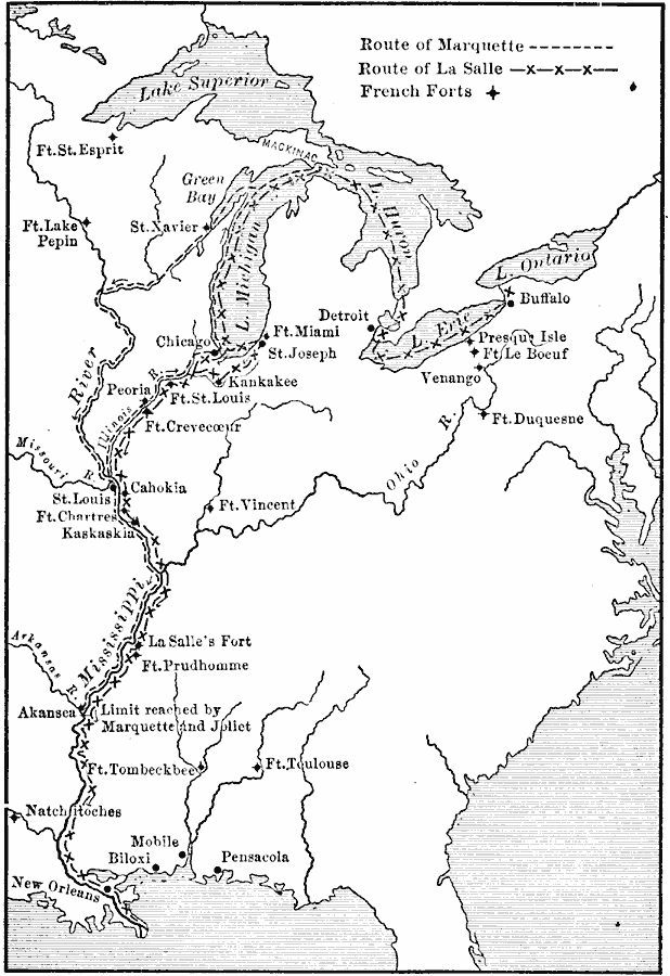
Description: A map of North America showing the routes of early French exploration of the Mississippi Valley from the Great Lakes to the Gulf of Mexico in the 1600's. The map shows the routes of Father Jacques Marquette (with Louis Jolliet) and Robert LaSalle (René–Robert Cavelier, Sieur de la Salle), and the French forts established in the area at the time.
Place Names: Early America 1400-1800, Biloxi, �Buffalo, �Mobile, �New Orleans, �Pensacola, �St. Louis, �French, �Discover
ISO Topic Categories: oceans,
location,
inlandWaters
Keywords: French Explorations and Forts, historical, �transportation, roads, historical event, oceans,
location,
inlandWaters, Unknown, 1600s
Source: Jacques W. Redway, F.R.G.S., The Redway School History (New York, NY: Silver, Burdett and Company, 1911) 108
Map Credit: Courtesy the private collection of Roy Winkelman |
|