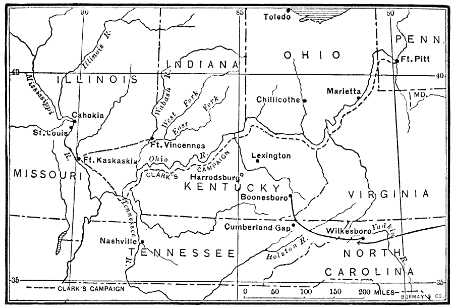
Description: A map showing the route of Colonel George Rogers Clark's Campaign in the Northwest (1778–1779) during the American Revolutionary War. The map shows Clark's starting point at Fort Pit, and route along the Ohio River to the British Fort Kaskaskia on the Mississippi River (1778) and British Fort Vincennes on the Wabash River (1779).
Place Names: Early America 1400-1800, Illinois, �Indiana, �Kentucky, �Missouri, �North Carolina, �Ohio, �Pennsylvania, �Tennessee, �Virginia, �American Revolution, �Clark's Campaig
ISO Topic Categories: oceans,
location,
inlandWaters
Keywords: Clark's Campaign in the Northwest, political, �transportation, �historical, kAmericanRevolution, local jurisdictions, water routes,
roads, American Revolution, oceans,
location,
inlandWaters, Unknown, 1778–1779
Source: Jacques W. Redway, F.R.G.S., The Redway School History (New York, NY: Silver, Burdett and Company, 1911) 162
Map Credit: Courtesy the private collection of Roy Winkelman |
|